

Tibradden Mountain [Sliabh Thigh Brodain]
Good walks are even better shared.
O1422 : At Hut circle, Tibradden Mountain, Co Dublin
Colin Park Photo source
Overview
Tibradden Mountain is a 466.2 m granite hill in the Dublin Mountains, approached through Pine Forest from the R116. Its open upper slopes overlook Dublin and Dublin Bay, and the summit area contains a prehistoric burial cairn. The Dublin Mountains Way crosses the hill and links it with Fairy Castle on Two Rock Mountain.
Tibradden Mountain
Overview
Tibradden is a 466.2 m granite hill in the Dublin Mountains. Pine Forest covers its lower slopes; open heather, blanket bog and rock occupy the upper ground. The summit area looks over Dublin and Dublin Bay and contains a prehistoric burial cairn. The precise highest-point feature is not recorded in the Database of British and Irish Hills.
Walking routes
Tibradden summit return from Pine Forest
Start and finish at Tibradden Wood car park beside the R116. Follow the red-waymarked mountain trail through the forest and onto the open ridge to the summit area and cairn. Retrace the same approach to the car park. The signed through-trail continues beyond the cairn, so turn back here for this summit-only walk.
Tibradden and Fairy Castle return
Follow the same approach to Tibradden, then continue southeast on the Dublin Mountains Way. Join the shared Wicklow Way section and follow the named Dublin Mountains Way signs towards Fairy Castle on Two Rock Mountain. Return over Tibradden by reversing the whole route to the original car park. At shared yellow-hiker waymarks, check the route-name plaques carefully.
These are complete out-and-back descriptions. Published trail distances differ and do not clearly describe the same return itinerary, so no distance, ascent or duration is assigned here. The Fairy Castle extension needs more time and upland preparation than the Tibradden-only return.
Cairn and name
The cairn is a protected prehistoric burial monument. Its 1849 excavation revealed a cist with Bronze Age pottery and cremated remains; later conservation altered its appearance. A possible earlier Neolithic origin remains uncertain. Niall Dhú’s supposed burial here is a local tradition, not established archaeology. Leave the monument and its stones undisturbed.
Tibradden derives from Tigh Bródáin, usually translated as “Brodáin’s House”.
Access and facilities
Use the signed Pine Forest car park off the R116. Parking is free. Coillte and Dublin Mountains Partnership currently publish conflicting seasonal gate hours: check the signs at the entrance and current notices, and return before the posted closing time. These are car-park restrictions, not evidence of identical pedestrian opening hours.
TFI Local Link SD4 links Tallaght Luas with the stop outside Tibradden Wood on Saturdays only. Check the operator’s current timetable and arrange your return journey. Take care at the roadside and crossing the R116.
There are picnic facilities and walking trails. There are no general public toilets or bins; the on-site Zipit compost toilets are for its customers. Bring water and take rubbish home.
Safety and conservation
Wet granite, uneven paths and boardwalks may be slippery. Carry suitable footwear, waterproofs and navigation for the open ridge, particularly in mist or wind. Snow and ice may close the car park at short notice; do not enter forests during a Met Éireann Red wind warning. Follow forestry closures and current signs. Keep dogs on leads around livestock and ground-nesting birds, and stay on established paths.
Sources
Checked 17 October 2026. Publication or update dates are distinct from this check; the DoBIH row revision is 11 December 2021.
Explore routes near Tibradden Mountain [Sliabh Thigh Brodain]
Walks starting near this hill. Open a route to check its map, distance and full itinerary.
Route planning notes
These notes describe possible approaches. Check a route's map and access information when planning your walk.
Tibradden summit return from Pine Forest
Start at Tibradden Wood car park beside the R116. Follow the red-waymarked mountain trail through the forest and uphill onto the open granite ridge to the summit area and prehistoric cairn. Return along the same approach to the same car park. The marked through-trail continues beyond the cairn, so turn back here for this summit-only outing.
Tibradden and Fairy Castle return from Pine Forest
From Tibradden Wood car park, follow the signed mountain trail to Tibradden’s summit area. Continue southeast on the Dublin Mountains Way, join the Wicklow Way section and follow the named Dublin Mountains Way signs towards Fairy Castle on Two Rock Mountain. After visiting that summit, retrace the route over Tibradden to the same car park. Check route-name plaques where the two ways share yellow hiker symbols; allow for the longer open-hill return.
Make a day of it, together
Find someone to share the walk with, or organise a day out along a route you like.
Photo Gallery
View all Photo could not load
O1422 : At Hut circle, Tibradden Mountain, Co Dublin
Colin Park
Hill facts and local notes
Classifications
Elevation
466m
1,530 ft
Prominence
28m
Coordinates
53.2386, -6.2804
O148222
OS Map
50
At the Summit
The summit area contains granite outcrops and Tibradden Cairn, a prehistoric burial monument with an exposed chamber and a stone-lined cist. Leave the monument and its stones undisturbed.
Terrain & Geology
Granite underlies Tibradden, with large boulders scattered across its slopes. The lower slopes support mixed woodland, including Scots pine, while heather and blanket bog occupy much of the open upper ground.
Views & Scenery
In clear conditions the open summit area overlooks Dublin city and Dublin Bay. Fairy Castle on Two Rock Mountain is visible to the east and the Hell Fire Club to the northwest.
History & Heritage
Name Origin
Tibradden comes from Tigh Bródáin, usually interpreted as “Brodáin’s House”. The Placenames Database records Tigh Bródáin as the validated Irish townland name; the name may refer to the ancient cairn.
Historical Significance
Tibradden Cairn is a protected prehistoric burial monument. Excavation in 1849 revealed a central cist with a Bronze Age pottery vessel and cremated remains. Conservation work in the 1950s helped shape its present appearance. An earlier Neolithic origin has been suggested but is uncertain. The association with the medieval king Niall Dhú is folklore, not an established burial identification.
Getting There & Facilities
Parking
Free parking is available inside Tibradden Wood (Pine Forest), off the R116. Coillte and Dublin Mountains Partnership publish different seasonal gate hours, so check the entrance signs and current manager notices before setting out and return before the posted closing time. Snow, ice or forestry work can restrict access at short notice; keep forest gates clear.
Public Transport
TFI Local Link route SD4 connects Tallaght Luas with the stop outside Tibradden Wood on Saturdays only, also serving Cruagh Wood and the Hell Fire Club area. Check the operator’s current timetable and plan the return journey before setting out. Take care beside and when crossing the R116.
Nearby Facilities
Tibradden Wood has parking, picnic facilities, marked walking trails and a separately operated Zipit aerial-adventure attraction. There are no general public toilets or bins; Zipit’s compost toilets are for its customers. Bring drinking water and take litter home.
Safety Information
Known Hazards
- Wet granite, uneven paths and boardwalks can be slippery. The open ridge is exposed to wind, mist and cold; carry appropriate footwear, waterproofs and navigation.
- On the Fairy Castle extension, read the named route plaques where the Dublin Mountains Way and Wicklow Way share yellow hiker symbols. Return by your planned route rather than following an unfamiliar onward trail.
- Respect forestry closures and warning signs. Snow or ice can close the car park at short notice; do not enter forest areas during a Met Éireann Red wind warning.
- Keep dogs on leads to protect livestock and ground-nesting birds. Stay on established paths and leave the burial cairn undisturbed.
Seasonal Hazards
Winter snow and ice can make the trails slippery and close the car park. Short daylight and seasonal gate changes require an early return plan. Check the forecast and current Coillte/Dublin Mountains Partnership notices before visiting.
General Safety Tips
- Check weather conditions before setting out
- Carry appropriate clothing and equipment
- Let someone know your planned route
- Take a map, compass, and GPS device
- Carry emergency supplies: food, water, first aid kit, torch
Hills
Some common questions about the hills answered
Are there group walks up Tibradden Mountain [Sliabh Thigh Brodain]?
Many walkers use Walkmates to join or organise walks with others. You can check for group walks around Tibradden Mountain [Sliabh Thigh Brodain] through the maps
Are there other walkers around Tibradden Mountain [Sliabh Thigh Brodain]?
Activity varies by location and time, but Walkmates lets you see whether others have shared walks or shown interest in this area. Find other people through the walking friends search walking friends for Tibradden Mountain [Sliabh Thigh Brodain] search or of course create your own walk for Tibradden Mountain [Sliabh Thigh Brodain]
Can I organise a walk to Tibradden Mountain [Sliabh Thigh Brodain]?
Yes. If there aren’t any walks listed already, you can create a walk and make it available for others to join.
If you're signed up to Walkmates, you can create a walk to Tibradden Mountain [Sliabh Thigh Brodain].
How do I find a walk up this hill?
There are often multiple ways to walk this hill, depending on experience and route preference. Walkmates helps you explore walks and routes that others have shared.
Can I suggest a new route up Tibradden Mountain [Sliabh Thigh Brodain]?
Yes. You can suggest or create routes to share with others. Walkmates focuses on the social side of walking, so routes are used to help people organise walks and explore areas together, rather than as detailed navigation tools or route libraries.
Other uses really appreciate knowledgeable walkers sharing their routes. Share your favourite route to Tibradden Mountain [Sliabh Thigh Brodain] here
The is an error or something incorrect about this hill. How do I let you know?
We always strive to keep the information on Walkmates as accurate as possible. If you find an error, please let us know through the contact form and we'll aim to correct it as quickly as possible
Community Discussion
Comments
Location
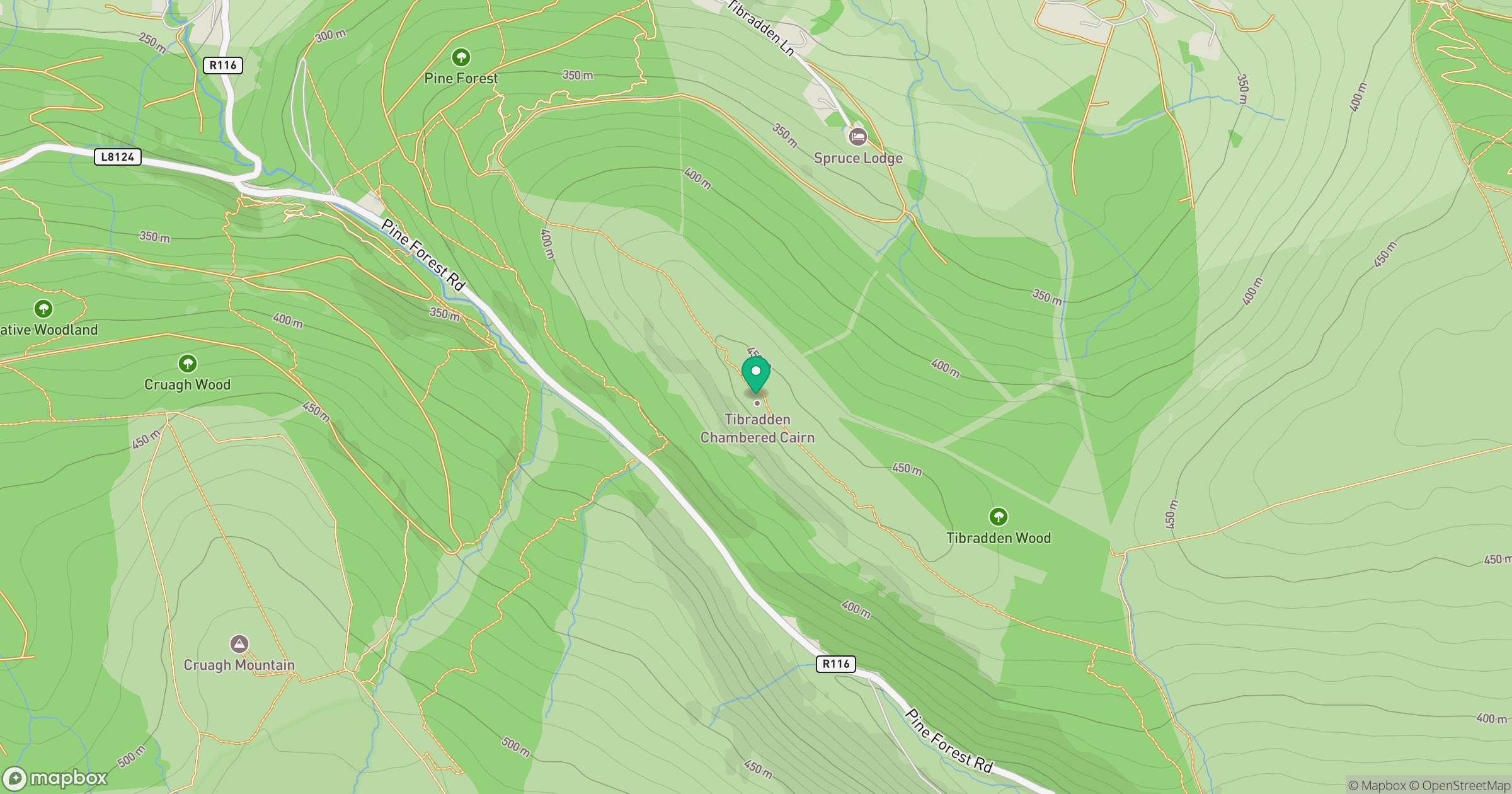
Grid reference: O148222
View on OpenStreetMapOpens a map in a new tab, centred on the hill.
Nearby Hills
Mullaghcleevaun
847m
Lugnaquilla [Log na Coille]
925m
Slieve Foye
587m
Slieve Gullion
576m
Slieve Binnian
746m
No comments yet. Be the first.